06 / Boating & fishingGuides & regulations.
Wake Boat Guidance
Grace Lake Recommended Wake Boat Area
Wake surfing and wake boating should be done in water at least 20 feet deep and at least 500 feet from shore. This minimizes shoreline erosion, sediment disturbance, and property impacts. The map was purchased through Minnesota Lakes & Rivers Association and shows the recommended area for Grace Lake — the purple zone covers the central deeper water.
Large wakes produced at certain speeds can cause shoreline erosion, impair water quality, damage docked boats, and create safety hazards. You are responsible for your wake.
Download map (JPG) →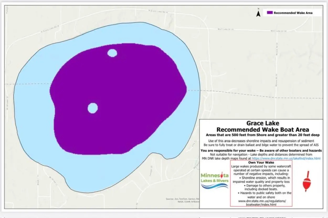
Click map to view full size. Source: Minnesota Lakes & Rivers Association.
-
Open PDF →Minnesota Boating GuideThe current Minnesota boating regulations handbook from MN DNR.
-
Open PDF →Minnesota Fishing RegulationsCurrent-year fishing handbook. Season dates, limits, and special regulations.
-
Visit →MN Infested Waters Map (MPR)Minnesota Public Radio’s searchable map of AIS-infested waters — a good visual tool for checking lakes you plan to fish.